
What Is the Wild Atlantic Way?
The Wild Atlantic Way is a 2,500 km (1,553-mile) coastal driving route along Ireland's western seaboard, running from the Inishowen Peninsula in Donegal to Kinsale in Cork. Launched in 2014, it passes through nine counties and has 157 Discovery Points. It is the longest defined coastal touring route in the world, passing through the Claddagh in Galway, where the Claddagh ring originated.
The Wild Atlantic Way is a 2,500 km coastal driving route that traces the entire western seaboard of Ireland. It runs from the Inishowen Peninsula at Ireland's northern tip in County Donegal to the harbor town of Kinsale in County Cork.
Failte Ireland launched the route in 2014, and it quickly became the country's flagship tourism experience. The concept was simple: connect the existing roads, villages, cliffs, and beaches along the Atlantic coast into a single defined route with consistent signage and discovery points.
The numbers behind the route tell part of the story. Nine counties. 157 official Discovery Points marked by distinctive brown and blue signposts. Fifteen Signature Discovery Points designated for their exceptional quality. But the numbers do not explain what the route actually feels like.
The Wild Atlantic Way changes character every hour. In Donegal, the road rises along 601-meter sea cliffs at Slieve League and drops to empty white-sand beaches on Achill Island. In Galway, it passes through the city where the Claddagh ring was born, then turns west into the rocky isolation of Connemara. In Clare, the Cliffs of Moher rise 214 meters above the Atlantic. In Kerry, Skellig Michael sits on a rock 12 kilometers offshore, a 6th-century monastery where monks lived in beehive huts for 600 years.
The route passes through three provinces (Ulster, Connacht, and Munster) and nine counties: Donegal, Leitrim, Sligo, Mayo, Galway, Clare, Limerick, Kerry, and Cork. Driving the full route without stops takes approximately 24 hours. Most people take between five and fourteen days.
The Stops Along the Wild Atlantic Way
The Wild Atlantic Way has 157 Discovery Points, but these ten stops represent the essential experiences from north to south. Driving times are approximate and assume no detours.
H3: 1. Malin Head, County Donegal
Ireland's most northerly point. A dramatic headland where the Atlantic meets the coast with full force. The signal tower at Banba's Crown dates to 1805, built during the Napoleonic Wars. On clear days, you can see the Scottish coastline. The "EIRE" sign spelled in stones on the clifftop was laid during World War II to warn Allied pilots they were over neutral territory.
Drive from starting point: This is the starting point (or close to it).
H3: 2. Slieve League Cliffs, County Donegal
At 601 meters, the Slieve League (Sliabh Liag) sea cliffs are among the highest accessible sea cliffs in Europe, nearly three times the height of the Cliffs of Moher. The cliff face drops almost vertically into the Atlantic. A narrow ridge path called One Man's Pass follows the cliff edge for hikers who are comfortable with exposure.
Drive from Malin Head: Approximately 2 hours (130 km).
H3: 3. Keem Bay, Achill Island, County Mayo
A sheltered horseshoe beach at the western end of Achill Island, Ireland's largest offshore island. The road to Keem Bay descends steeply through a mountain pass above the Atlantic. Achill is connected to the mainland by a bridge but feels like a separate world. The deserted village at Slievemore on the island was abandoned during the Great Famine.
Drive from Slieve League: Approximately 2 hours 30 minutes (170 km).
H3: 4. Westport and Croagh Patrick, County Mayo
Westport is a planned Georgian town designed by James Wyatt in the 1770s, consistently rated one of the best places to live in Ireland. Croagh Patrick rises 764 meters above Clew Bay just outside town. Over 25,000 people climb it on Reek Sunday each July, many barefoot, continuing a pilgrimage tradition that predates Christianity.
Drive from Keem Bay: Approximately 1 hour 15 minutes (65 km).
H3: 5. Galway City and the Claddagh
Galway is the cultural capital of Ireland's west coast, a city of festivals, traditional music, and the Irish language. The Claddagh, a fishing village just outside the old city walls, is the birthplace of the Claddagh ring. The symbol of two hands clasping a crowned heart, representing love, loyalty, and friendship, has its roots in this community of Galway Bay fishermen. Today, the Claddagh ring is one of the most recognized Irish symbols worldwide.
For the full story, see our Claddagh Ring Meaning guide.
Drive from Westport: Approximately 1 hour 30 minutes (80 km).
H3: 6. Cliffs of Moher, County Clare
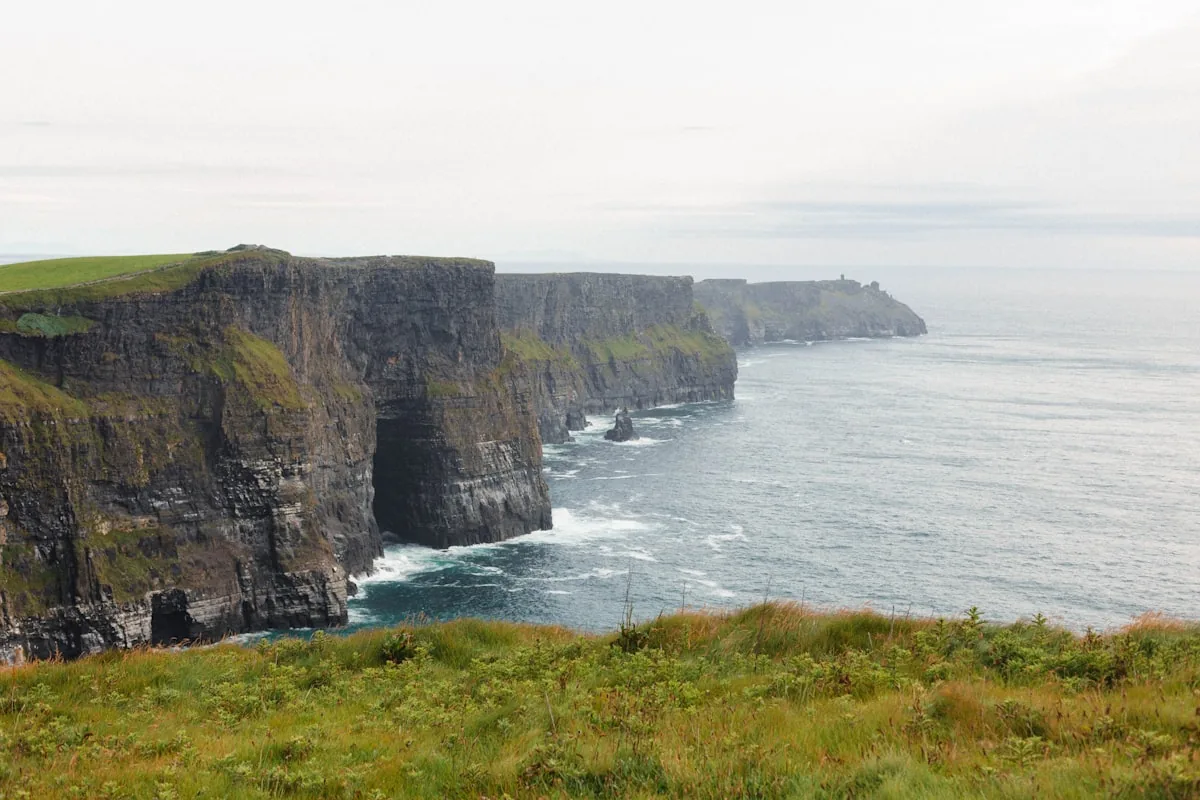
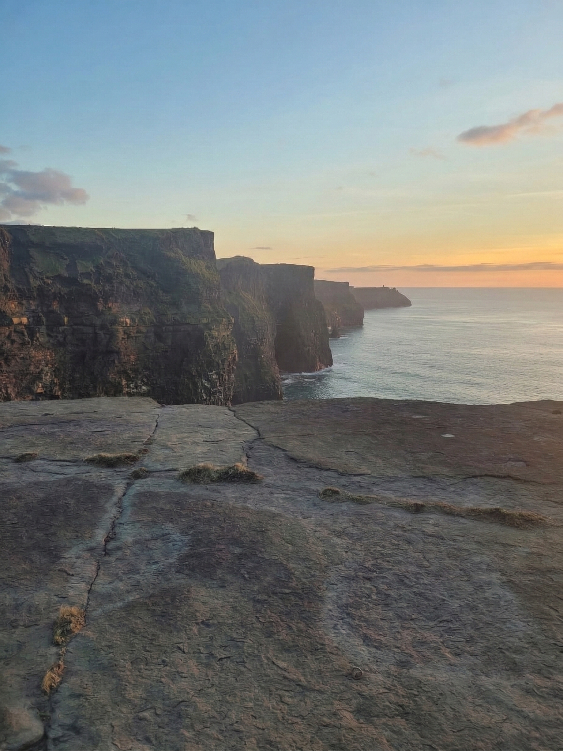
The Cliffs of Moher reach 214 meters at their highest point, just north of O'Brien's Tower, and stretch for 8 kilometers along the Clare coast. They are part of the Burren and Cliffs of Moher UNESCO Global Geopark, a landscape spanning over 330 million years of geological history. The cliffs are a Special Protection Area for seabirds, home to approximately 30,000 breeding pairs including Atlantic puffins, guillemots, and razorbills. Voted Ireland's Best Visitor Attraction in 2023.
Drive from Galway: Approximately 1 hour 30 minutes (75 km).
H3: 7. Dingle Peninsula, County Kerry
The Dingle Peninsula (Corca Dhuibhne) is one of Ireland's strongest Irish-speaking Gaeltacht regions. You will hear Irish spoken in shops, pubs, and on road signs. The peninsula has the highest concentration of Ogham stones in Ireland, ancient stone markers carved with Ireland's earliest alphabet. The town of Dingle is a working fishing port with a food scene that draws visitors from across the country.
For more on Ireland's ancient alphabet, see our Ogham Alphabet guide.
Drive from Cliffs of Moher: Approximately 2 hours 30 minutes (150 km via Killimer ferry or 3 hours via Limerick).
H3: 8. Skellig Michael, County Kerry
A UNESCO World Heritage Site, 12 km off the Kerry coast. Monks founded a monastery here in the 6th century and lived in beehive-shaped stone huts perched 218 meters above the Atlantic for roughly 600 years. The 618 stone steps to the monastery summit are original, carved by the monks themselves. The island gained worldwide fame as Luke Skywalker's retreat in Star Wars: The Force Awakens and The Last Jedi. Boat trips from Portmagee and Valentia Island operate May to October. Permits are limited, so advance booking is essential.
Drive from Dingle: Approximately 1 hour 30 minutes to Portmagee (75 km).
H3: 9. Ring of Kerry, County Kerry
The Ring of Kerry is a 179 km circular driving route around the Iveragh Peninsula. It is one of the most famous scenic drives in Ireland and forms a major section of the Wild Atlantic Way. The route passes through Killarney, Kenmare, Sneem, Waterville, and Cahersiveen. Full details in our Ring of Kerry guide.
Drive from Portmagee: The Ring of Kerry loop begins approximately 1 hour east at Killarney.
H3: 10. Mizen Head, County Cork
Ireland's most south-westerly point. A signal station sits on a rock connected to the mainland by an arched concrete bridge spanning a deep gorge. The views south and west are open Atlantic, with nothing between here and North America. The visitor center tells the story of the lighthouse keepers who lived in near-complete isolation at this point. Many people consider Mizen Head the symbolic end of the Wild Atlantic Way (the route officially ends at Kinsale, further east).
Drive from Killarney: Approximately 2 hours 15 minutes (140 km).
Driving the Wild Atlantic Way, What You Need to Know
The full Wild Atlantic Way takes approximately 24 hours to drive without stops, though most travelers spend 5-14 days on the route. It passes through nine counties from Donegal to Cork. The best season is May to September. Atlantic weather is unpredictable, so layers and waterproof gear are essential.
The Wild Atlantic Way covers 2,500 km, so planning matters. Here are the practical details.
| Detail | Information |
|---|---|
| Total length | 2,500 km (1,553 miles) |
| Driving time (no stops) | Approximately 24 hours |
| Recommended duration | 5-14 days |
| Starting point | Most people start at either end: Donegal (north) or Cork (south). Galway is a common midpoint entry. |
| Best season | May to September for the longest daylight and mildest weather. June and July are busiest. May and September offer fewer crowds. |
| Road conditions | Main roads are good. Coastal sections and peninsulas have narrow, winding roads. A smaller car is easier to navigate. |
| Fuel | Fill up in towns. Rural stretches in Donegal, Mayo, and Kerry have fewer stations. |
| Weather | Atlantic weather changes fast. Expect rain, sun, and wind on the same day. Bring layers and waterproof gear. |
| Signage | Follow the brown-and-blue Wild Atlantic Way signs featuring a wave-shaped line. |
The Wild Atlantic Way and Irish Heritage
The Wild Atlantic Way is not just a scenic drive. It passes through some of the oldest and most culturally significant sites in Ireland.
The Claddagh ring was born on this coastline. The fishing village of the Claddagh in Galway sits directly on the route, and the ring's symbols of love, loyalty, and friendship emerged from this Atlantic community. When you drive the Wild Atlantic Way through Galway, you are passing through the neighborhood where Richard Joyce, the legendary creator of the Claddagh ring, lived and worked.
Connemara, just west of Galway, is the source of Connemara Marble, Ireland's ancient green stone, over 900 million years old. It is found only in this part of western Ireland and is used in Celtic jewelry as a connection to the Irish landscape. See our Connemara Marble guide.
The Aran Islands, visible from the Clare coast, preserve an older way of Irish life. The islands are home to Dun Aonghasa, a prehistoric stone fort on the cliff edge of Inishmore, and are one of the strongest Irish-speaking communities remaining. The knitting patterns of Aran sweaters carry family identity, each stitch representing a different aspect of island life. See our Aran Sweater Meaning guide.
The Dingle Peninsula holds the densest concentration of Ogham stones in Ireland, the ancient tree alphabet that predates the Latin script in Ireland. These carved stones are the earliest surviving written records in the Irish language. See our Ogham guide.
Explore Irish Heritage Jewelry →
Explore More Heritage Trails
- Ring of Kerry: 179 km loop through Kerry's mountains and coast, a section of the Wild Atlantic Way
- Causeway Coastal Route: Northern Ireland's dramatic coast from Belfast to Derry, including Giant's Causeway
- Ireland's Ancient East: The eastern counterpart, from Newgrange to Waterford
- Celtic Monastery Trail: Skellig Michael, Glendalough, and the island monasteries