
What Is the Ring of Kerry?
The Ring of Kerry is a 179 km (111-mile) circular driving route around the Iveragh Peninsula in County Kerry, southwestern Ireland. The route is driven counterclockwise and takes approximately 3.5-4 hours without stops, or a full day (6-8 hours) with stops. Key attractions include Skellig Michael, Moll's Gap, Ladies' View, Staigue Fort, and the towns of Kenmare, Sneem, and Waterville.
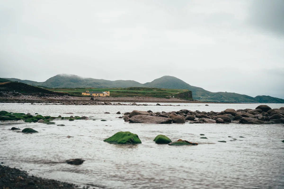
The Ring of Kerry is a road. One hundred seventy-nine kilometers of asphalt winding around the Iveragh Peninsula in County Kerry — Ireland's southwestern corner, where the mountains meet the Atlantic.
But calling it a road undersells it the way calling the Book of Kells a book undersells it.
The Ring of Kerry passes through landscapes that change every ten minutes. Mountains that drop directly into the sea. Beaches with no footprints. Stone villages that look the same as they did a hundred years ago. Sheep that own the road. Atlantic weather that shifts from sun to rain to sun again in a single hour.
The drive takes approximately 3.5 to 4 hours without stops — but nobody does it without stops. With stops for views, villages, food, and the dozen moments where you pull over because you cannot believe what you are looking at, plan for a full day (6-8 hours).
The route is driven counterclockwise by convention. Tour buses go counterclockwise, and the narrow roads mean two buses cannot easily pass each other. If you drive clockwise, you will be driving toward the buses around blind corners. Go counterclockwise.
Best Stops on the Ring of Kerry
Killarney — The Starting Point
Most people start (and end) in Killarney — a tourism hub with hotels, restaurants, and easy access. Killarney National Park — Ireland's first national park — is worth a half-day before or after the Ring. The park contains the Lakes of Killarney, Ross Castle (15th century), and Muckross House (1843).
Moll's Gap
A mountain pass between Killarney and Kenmare. The road climbs through the MacGillycuddy's Reeks — Ireland's highest mountain range — and the views from Moll's Gap across the valley are among the best on the route. Stop at Avoca Café for tea and the panorama.
Kenmare
A colorful, elegant town at the head of Kenmare Bay. Known for its food scene, craft shops, and the Kenmare Stone Circle — a Bronze Age circle of 15 stones that predates the Celts.
Sneem
A village of brightly painted houses at the point where the route turns north along the coast. Small, quiet, and photogenic. The kind of place where you stop for five minutes and stay for an hour.
Staigue Fort
A circular stone fort dating to approximately 300-400 AD — one of the best-preserved examples of an ancient Irish cashel (stone fort). The dry-stone walls stand up to 5 meters high and 4 meters thick. Entry is free. The fort sits in farmland — follow the signs from the main road.
Waterville
A seaside town facing the Atlantic. Charlie Chaplin spent his holidays here, and there is a statue of him on the seafront. The beach at Waterville stretches for miles, and the views south toward the Skelligs are exceptional on clear days.
Valentia Island & Skellig Michael
Valentia Island — connected to the mainland by a bridge — is the jumping-off point for boat trips to Skellig Michael, the 6th-century island monastery that became globally famous as a Star Wars filming location (Luke Skywalker's island in The Force Awakens and The Last Jedi).
Skellig Michael is a UNESCO World Heritage Site — a cluster of beehive-shaped stone huts perched on a rock 218 meters above the Atlantic, where monks lived in near-total isolation from the 6th to 12th century. The 600 stone steps to the top are original — carved by the monks over a thousand years ago.
Boat trips to Skellig Michael operate from May to October, weather permitting. Advance booking is essential — permits are limited.
Ladies' View
A viewpoint overlooking the Lakes of Killarney, named because Queen Victoria's ladies-in-waiting loved the view during her 1861 visit. On a clear day, the three lakes stretch below you, flanked by oak forest and mountains. It is the single most photographed stop on the entire Ring.
Driving the Ring of Kerry — Tips That Matter
| Tip | Why It Matters |
|---|---|
| Drive counterclockwise | Tour buses follow this direction. Going clockwise means head-on encounters on narrow roads. |
| Start early (by 9am) | The road gets busy from 10am onward. Early starters have many stops to themselves. |
| Allow 6-8 hours | Without stops: 3.5-4 hours. With stops: a full day. Do not rush this. |
| Fill your tank | Petrol stations are limited on the western stretch. Fill up in Killarney or Kenmare. |
| Weather is irrelevant to planning | It will rain. It will also be sunny. Often on the same afternoon. Bring layers and a waterproof. |
| Smaller car is better | The roads are narrow. A compact car handles the turns and passing spots far better than an SUV. |
| Book Skellig Michael in advance | Boat permits are limited. Trips sell out weeks ahead in peak season. |
The Ring of Kerry's Ancient Heritage
The Iveragh Peninsula has been inhabited for over 4,000 years. The Ring of Kerry is not just scenery — it is a drive through layers of Irish history.
- Ogham Stones — the Kerry Gaeltacht (Corca Dhuibhne, on the Dingle Peninsula just north) has the highest concentration of Ogham stones in Ireland. Ogham is Ireland's ancient tree alphabet — see our Ogham guide.
- Staigue Fort — a 1,700-year-old stone fort standing intact in Kerry farmland.
- Skellig Michael — monks chose this remote Atlantic rock for precisely its remoteness. A monastery older than most European cities, clinging to a precipice.
- Kerry Gaeltacht — the Dingle Peninsula is one of Ireland's strongest Irish-speaking regions. You will hear Irish spoken in shops, pubs, and on road signs.
- The Famine — the western coast was devastated by the Great Famine (1845-1852). Abandoned villages, famine walls (stone walls built as relief work), and mass graves are scattered along the route. The landscape is beautiful. The history it holds is not.
Irish Heritage Jewelry Inspired by Kerry's Wild Coast
Kerry's landscape — mountains into ocean, stone forts on cliff edges, monks surviving on Atlantic rocks — translates into powerful men's jewelry:
- Celtic warrior bands — broad rings with textured, stone-inspired surfaces. The raw stone of Staigue Fort and Skellig Michael informs these designs.
- Ogham inscriptions — the ancient script found on stones across Kerry. Names, dates, or Irish words like "Neart" (strength) carved in the oldest Irish writing system.
- Atlantic-inspired pieces — rings and pendants with wave or cliff-edge motifs drawn from Kerry's coastline.
- Celtic cross rings — connected to the monastic tradition that placed Skellig Michael on the map.
Kerry-Inspired Jewelry for Women — Wild Atlantic Beauty
The Ring of Kerry's dramatic beauty inspires women's Celtic jewelry that captures Ireland's western landscape:
- Celtic knot pendants — the continuous line echoing the circular route itself. Kerry is a ring — the jewelry mirrors the journey.
- Connemara Marble pieces — Ireland's green stone connecting to the green mountains that rise above the route.
- Claddagh rings from the western tradition — the Claddagh comes from Galway, just north. The same Atlantic coast, the same heritage, the same promise of love, loyalty, and friendship.
- Birthstone pieces — emerald (May, Ireland's green) or aquamarine (March, the Atlantic sea) set in Celtic designs inspired by Kerry's coastline.
Explore More Heritage Trails
- Wild Atlantic Way: The Ring of Kerry forms a major section of Ireland's 2,500 km western coast route
- Ring of Beara: The quieter 137 km loop around the neighboring Beara Peninsula
- Celtic Monastery Trail: Skellig Michael is a key stop on the Irish monastic trail
- Dingle Peninsula: The neighboring peninsula with the highest concentration of Ogham stones in Ireland